
Número 68(1) • Enero-junio 2022
ISSN: 1011-484X • e-ISSN 2215-2563
URL: www.revistas.una.ac.cr/index.php/geografica/
Licencia (CC BY-NC-SA 4.0)
La REVISTA GEOGRÁFICA DE AMÉRICA CENTRAL es una publicación de la Escuela de Ciencias Geográficas de la Facultad de Ciencias de la Tierra y el Mar de la Universidad Nacional, Costa Rica; publicada periódicamente por la Editorial de la Universidad Nacional (EUNA) desde 1974.
La revista está destinada a difundir la Ciencia Geográfica y temáticas afines en todos los ámbitos por medio de la publicación de trabajos originales, informes inéditos o adelantos de investigación que tengan especial relación con América Central, abordando temáticas propias de la Geografía: estudios regionales, problemáticas urbano/rural, ordenamiento territorial, recursos naturales y su relación con el medio geográfico, manejo de cuencas hidrográficas, ciencias de la información geográfica, análisis demográfico, temas relacionados con epistemología y la enseñanza de esta disciplina. Además, constituye un foro de expresión de la opinión profesional y de la discusión académica, y como tal, en él tienen cabida todos los aportes científicos que alcancen esta finalidad.
En esta oportunidad, corresponde la publicación No. 68 de la Revista Geográfica de América Central del I semestre de 2022 (enero-junio). Incluye 15 artículos ubicados en las diferentes secciones de la revista: teoría, epistemología, metodología y estudios de caso.
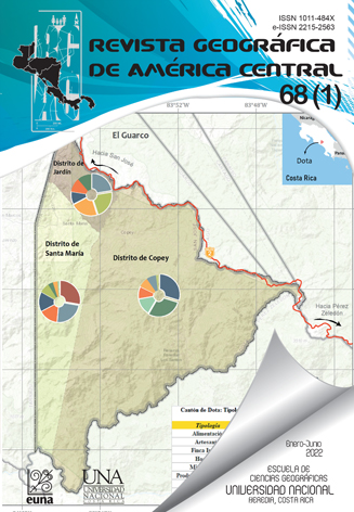
El primer artículo comparte el abordaje metodológico en la identificación y clasificación de los emprendimientos asociados a la actividad turística en el cantón de Dota, así como sus patrones de comportamiento espacial. A partir de ello se generó un análisis espacial de la oferta turística que sirve de base para el proceso de toma de decisiones relacionado con la planificación y gestión del sector turístico del cantón de Dota. Esto como como parte de los resultados del proyecto de extensión académica titulado “Turismo experiencial y patrimonio biocultural en Los Santos: organización comunitaria para la innovación y el encadenamiento de la oferta de bienes y servicios turísticos” de la Universidad Nacional de Costa Rica (UNA).
El segundo artículo revisa el estado de la literatura existente frente a la evaluación de políticas públicas de planeación territorial ambiental en Colombia. Para ello, se procedió a realizar una revisión metódica de los artículos publicados en revistas indexadas, en las bases de datos SciELO.org y EBSCO Information Services en el período comprendido entre el año 1995 y 2020. Analizando artículos que respondieron, principalmente, a las temáticas de evaluación de políticas públicas y planeación territorial ambiental en Colombia, se obtuvo el estado de arte de la evaluación de política pública en el tema específico de planeación territorial ambiental en Colombia y se establecieron algunas recomendaciones para fortalecer la divulgación de los procesos de evaluación de política pública en el país.
El tercer artículo estimó la deformación superficial experimentada en la ladera oeste del cráter del volcán Turrialba tras la erupción del 1 de agosto de 2020 con el uso de la técnica interferometría diferencial con radar de apertura sintética (SAR), reconocida en teledetección por sus aplicaciones en la generación de modelos digitales del terreno y el monitoreo de deformaciones de la corteza terrestre. Se utilizaron varias imágenes captadas por el sensor Sentinel 1A, de la Agencia Espacial Europea.
El cuarto artículo analiza el aumento del nivel del mar tomando como base el nivel promedio de mareas altas para la región Caribe de Costa Rica, considerando cuatro escenarios de acuerdo con los siguientes años: 2030, 2050, 2070 y 2100, para las localidades de Cahuita y Moín en la provincia de Limón. Se estudian los niveles de mareas astronómicas a partir de predicciones mareales. Los resultados muestran los niveles de inundación para cada uno de los años en las localidades de Moín y Cahuita, e indica que ambas localidades podrían ser inundadas para el año 2100.
El quinto artículo presenta un análisis de cinco conjuntos residenciales de proyectos de vivienda de interés social desarrollados en la Gran Área Metropolitana de Costa Rica, entre el año 2011 y 2018. Los proyectos de este tipo se caracterizan por estar localizados en zonas alejadas de centros urbanos o con limitado acceso a equipamientos e infraestructuras, debido al elevado costo del suelo en los sectores más céntricos de la ciudad. Las condiciones y características de estos entornos, los usos del suelo, las configuraciones morfológicas, la continuidad y la contigüidad entre los proyectos de Vivienda de Interés Social y las piezas urbanas donde se insertan, son analizados en esta investigación. Los resultados alcanzados posibilitaron identificar las principales dificultades desprendidas del encaje morfológico y tipológico que siguieron los conjuntos residenciales, así como las problemáticas contextuales por la locación de los proyectos.
El sexto artículo presenta la versión en inglés del artículo anterior.
El sétimo artículo presenta un estudio que hace uso de la teoría de la interacción espacial para explicar la devoción a la imagen reconocida como Cristo Mojado. Antecedentes de esta tradición referencian que, en el año 2003, migrantes de origen centroamericano trasladaron de manera indocumentada a la ciudad de Los Ángeles, California, una réplica del Señor de Esquipulas, un Cristo de tez obscura de origen guatemalteco; con su llegada a la Iglesia de Santa Cecilia, la devoción a la imagen se expandió. Los hallazgos señalan que el culto al Cristo Mojado genera interacciones espaciales a corta y larga distancia, producto del movimiento cíclico de bienes materiales, personas e información.
El octavo artículo presenta un estudio que forma parte del diagnóstico ambiental que representa una sección de un levantamiento para el Plan Regulador de Siquirres. Con el propósito de caracterizar aspectos geológicos y geomorfológicos, se acude al uso de reportes técnicos, mapas temáticos, fotografías aéreas y trabajo de campo. Se realiza una delimitación y clasificación de formas de relieve; a las cuales, una vez individualizadas, se les describen tipos de amenazas naturales potenciales. Este levantamiento es un insumo para las tareas de ordenamiento del territorio cantonal mediante el Plan Regulador.
El noveno artículo analizó la formación de inundaciones por zonas funcionales en la subcuenca Santa Rosa Jáuregui, Querétaro. Se elaboraron zonas funcionales con variables hidrogeológicas en un sistema de información geográfica, se definieron unidades y secciones con análisis hidrogeomorfológico y se recopilaron registros de inundaciones con trabajo hemerográfico. A través de zonas funcionales, se determinó que las inundaciones resultan de procesos sistémicos y acumulativos que pueden ser utilizados en la gestión y mitigación de riesgo. Los resultados señalan que la zona funcional alta tiene una estructura óptima que beneficia cuenca abajo, pero las alteraciones hidrogeomorfológicas en la zona funcional media favorecen la formación de inundaciones en la zona funcional baja, la cual también cuenta con la urbanización de la llanura de inundaciones.
El décimo artículo evalúa la sostenibilidad y viabilidad de riego y técnicas de recarga artificial de acuíferos en la parte baja de la cuenca del río La Villa, mediante el aprovechamiento de aguas residuales tratadas procedentes de la PTAR de Chitré para su posterior recuperación por procesos naturales y uso como fuente alternativa de agua. Se evaluó la posibilidad de implementación de soluciones tecnológicas. Los resultados permitieron establecer el nivel de remoción en humedales de contaminantes del agua postratada con la ayuda del sustrato y vegetación seleccionada. Además, se logró, con la realización de los estudios geológicos e hidrogeológicos, generar un bloque modelo inédito de la disposición espacial de capas litológicas y estimar sus volúmenes, definiendo así la zona acuífera capaz de recibir por infiltración el agua de recarga, almacenarla y, posteriormente, entregarla para hacer buen uso de ella.
El undécimo artículo analiza las reglamentaciones asociadas al manejo de aguas pluviales en la capital nacional y las capitales provinciales de la Argentina, y reconocer así antecedentes en la implementación de políticas que favorezcan la provisión del servicio ecosistémico de regulación hídrica. Los resultados obtenidos se agruparon en: indicadores urbanísticos, zonificaciones y medidas de infraestructura verde. Si bien, el 87,5% de las ciudades analizadas presenta algún tipo de medida urbanística relacionada con el servicio ecosistémico de regulación hídrica, en la mayoría de los casos no existe una mención explícita. Esto dificulta la cuantificación, su nivel de provisión servicio y, por lo tanto, su incorporación efectiva en los instrumentos de planificación.
En el duodécimo artículo se analiza cómo los pasivos mineros abandonados en el Líbano de Tilarán, Guanacaste, Costa Rica, son una fuente potencial de contaminación por metales para las aguas, sedimentos y macroinvertebrados bentónicos de los ríos San José y Cañas. Las posibles consecuencias para el medio ambiente asociadas con la presencia de desechos mineros se evaluaron cuantitativa y cualitativamente a través de las cantidades de metales presentes en los desechos y lixiviados. Se realizaron pruebas de infiltración y una prueba cinética de celda húmeda, lo que permitió describir los procesos y las reacciones químicas que pueden ocurrir en los desechos mineros durante la lluvia, asociados con la carga de metales en el lixiviado. Esta investigación mostró que los pasivos mineros abandonados en el Líbano son una fuente potencial de contaminación por metales para los ecosistemas de agua dulce circundantes.
El décimo tercer artículo, a partir de la base de datos de 34 años de las 92 estaciones distribuidas en la región Sierra de Amula en el estado de Jalisco–México, estimó los datos mensuales faltantes de precipitación y temperatura a través de los métodos de media aritmética, regresión lineal simple y la técnica de la U.S. National Weather Service. La estimación de la consistencia y homogeneidad de esta base se realizó a través del análisis de doble masa, t de Student y Cramer, procesados mediante los Sistemas de Información Geográfica; resultando que el mejor método para interpolar la precipitación fue polynomial interpolation, mientras que para temperatura fue J-Bessel con una confiabilidad cercana a 100%.
En el décimo cuarto artículo se contribuye con el análisis de la erosión hídrica actual y potencial, y la variación de la pérdida total de suelos agrícolas del partido de Tres Arroyos (Región Pampeana Austral), para desarrollar un acercamiento a la estimación de la pérdida económica a causa de la merma de la productividad del suelo originada por la erosión hídrica en el área de estudio. Se determinó un aumento en la pérdida productiva debido al incremento del área sembrada y la existencia de procesos erosivos; traduciéndose en un perjuicio económico sobre los productores y en la necesidad de desarrollar estrategias enfocadas hacia un modelo de producción más sustentable.
El décimo quinto artículo analiza factores que han contribuido a las transformaciones territoriales en el Semiárido debido a la expansión agrícola de la cajucultura al municipio de Pio IX. El enfoque de desarrollo territorial se ha utilizado en la implementación de planes de desarrollo para el semiárido de Piauí. El anacardo familiar asumió el liderazgo en la reorganización del anacardo en el territorio, favorecido también por las nuevas organizaciones sociales y políticas resultantes de la organización de los trabajadores sin tierra en la búsqueda de la implementación de acciones de reforma agraria. Las acciones del estado desconocen la organización de la base productiva, además de la dimensión ambiental. Los distintos planes de desarrollo apuntan a caminos, pero no son muy efectivos para desencadenar acciones orientadas al desarrollo territorial.
De esta forma, se aprovecha para invitarlos a visitar el sitio electrónico de la revista (http://www.revistas.una.ac.cr/index.php/geografica), donde encontrarán en formato PDF, HTML y EPUB los artículos descritos. Adicionalmente, con mucho agrado les comunicamos que a partir del año 2019 la Revista Geográfica de América Central ha sido indexada en SCIELO, además de las indexaciones en LATINDEX, REDALYC, DIALNET, DOAJ, REDIB, entre otras.
Esperamos que este número sea de gran utilidad para todos los interesados en los estudios geográficos y los invitamos a enviar sus aportes.
Saludos cordiales,
Máster Lilliam Quirós Arias
Máster María Milagro Castro Solano
Máster Consuelo Alfaro Chavarría
The REVISTA GEOGRÁFICA DE AMÉRICA CENTRAL (translated as GEOGRAPHICAL JOURNAL OF CENTRAL AMERICA) is a publication of the School of Geographical Sciences of the Faculty of Earth and Sea Sciences at the Universidad Nacional (UNA), Costa Rica, published periodically by the Publishing Office of the Universidad Nacional (Editorial Universidad Nacional, EUNA) since 1974.
The Journal is intended to disseminate research and works of relevance in geography and related sciences through the publication of original works, unpublished reports, or research advances that hold special relation to Central America, addressing specific topics of Geography: regional studies, urban/rural issues, land use planning, natural resources and their relationship with the geographic environment, watershed management, geographic information sciences, demographic analysis, epistemology related matters and the teaching of this discipline. In addition, it constitutes a forum for the expression of professional opinion and academic discussion, and as such, it includes all scientific contributions to achieve this purpose.
On this occasion, it corresponds to publication N°68 of the Revista Geográfica de América Central of the first semester of 2022 (January-June). It includes 15 articles distributed throughout the different sections of the Journal: theory, epistemology, methodology and case studies.
The first article shares the methodological approach in the identification and classification of entrepreneurial activities associated with the tourism sector in the canton of Dota, Costa Rica, as well as their spatial behavior patterns. From this, a spatial analysis of available tourism offerings was generated that serves as the basis for a decision-making process related to the planning and management of the tourism sector of the canton of Dota. The above is part of the results obtained from the academic extension project entitled “Experiential tourism and biocultural heritage in Los Santos: community organization for the innovation and linkage of offerings of goods and services in the tourism sector”, promoted by the Universidad Nacional of Costa Rica (UNA).
The second article reviews the state of the art of existing literature regarding the evaluation of public policies for territorial-environmental planning in Colombia. A methodical review of articles published in indexed journals was carried out within research databases SciELO.org and EBSCO Information Services, for the period spanning from 1995 to 2020. By analyzing articles pertaining mainly to issues of public policy evaluation and territorial-environmental planning in Colombia, knowledge was generated about the state of the art on the subject matter, which led to establishing some recommendations seeking to strengthen the dissemination of the evaluation processes of public policy in the country.
The third article estimated the surface deformation that occurred on the western slope of the crater of the Turrialba volcano after the eruption of August 1, 2020, using the technique of differential synthetic aperture radar interferometry (SAR), recognized in remote sensing for its applications in the generation of digital terrain models and the monitoring of deformations of the Earth’s crust. Several images captured by the Sentinel-1A sensor of the European Space Agency were used.
The fourth article analyzes the rise in sea level based on the average level of high tides registered in the Caribbean region of Costa Rica, presenting possible scenarios for four different years: 2030, 2050, 2070 and 2100, at two different localities, Cahuita and Moín, both in the province of Limón, Costa Rica. Astronomical tidal levels are studied from tidal predictions. Results show flood levels for each considered year and indicate that both localities could be flooded by the year 2100.
The fifth article presents an analysis of five residential complexes of social interest housing projects developed in the Greater Metropolitan Area of Costa Rica, between 2011 and 2018. Housing projects of this type are characterized by being located in areas far from urban centers or possessing limited access to facilities and infrastructure, due to the high cost of land in the most central sectors of the city. The conditions and characteristics of these contexts, land uses (zoning), morphological configurations, continuity and contiguity between social interest housing projects and the urban pieces where they are inserted, are analyzed in this research. From the obtained results it was possible to identify the main difficulties arising from the morphological and typological fit that followed the establishment of residential complexes, as well as the contextual problems derived from the location of the projects.
The sixth article presents the English version of the previous article.
The seventh article presents a study that makes use of the theory of spatial interaction to explain the devotion to the image recognized as Cristo Mojado (Wetback Christ). Background information on this tradition reveals that in 2003, migrants of Central American origin, illegally relocated a replica of Señor de Esquipulas, a dark-skinned Christ of Guatemalan origin, to the city of Los Angeles, California; with the replica’s arrival at the Saint Cecilia Catholic Church, the devotion to the image expanded. The findings indicate that worship to the Cristo Mojado creates short- and long-distance spatial interactions, as a consequence of the cyclical movement of material goods, people and information.
The eighth article presents the findings of an environmental diagnosis that represents a section of a survey intended to be used for the creation of the Regulatory Plan (i.e., land use regulation plan) for the canton of Siquirres, Costa Rica. With the intention of characterizing geological and geomorphological aspects, use was made of technical reports, thematic maps, aerial photographs and field work activities. Demarcation and classification of landforms was carried out and thereafter each landform was assigned potential natural hazards. The survey constitutes an input for realizing the tasks involved in cantonal territorial planning through the use of the Regulatory Plan instrument.
The ninth article analyzed the occurrence of floods within functional zones in the Santa Rosa Jáuregui subwatershed, in the state of Querétaro, Mexico. Functional zones were elaborated with hydrogeological variables in a geographic information system, units and sections were defined by employing hydrogeomorphological analysis, and flood records were compiled from hemerographic research. Through consideration of functional zones, it was determined that floods result from systemic and cumulative processes whose awareness and consideration can be used for risk management and mitigation purposes. The results indicate that the high functional zone possesses an optimal structure that benefits the watershed downstream, however, hydrogeomorphological alterations in the middle functional zone favor the formation/occurrence of floods in the low functional zone, which finds its floodplain in an urbanized state.
The tenth article assesses the sustainability and viability of irrigation and artificial recharge techniques of aquifers in the lower section of the La Villa river basin, through the use of treated wastewater from the Chitré wastewater treatment plant (WWTP) for its subsequent recovery by natural processes and as an alternative source of water for different applications. The possibility of implementing technological solutions was evaluated. The results allowed to establish the level of contaminant removal by wetland post treatment with the help of the substrate and selected vegetation. In addition, with the realization of geological and hydrogeological studies, it was possible to generate an unprecedented block model of the spatial arrangement of lithological layers and to estimate their volumes, thus defining the aquifer zone capable of receiving recharge water by infiltration, storing it and, later, retransferring the hydric source to be put into use.
The eleventh article analyzes the regulations associated with the management of stormwater in the capital and the provincial capital cities of Argentina, and thus recognize background information regarding the implementation of policies that favor the provision of ecosystem services relevant to the regulation of water resources. The results obtained were grouped into: urban indicators, defined zoning areas, and green infrastructure measures. Although 87.5% of the considered cities exhibit some type of urban measure related to ecosystem services pertaining to the regulation of water resources, there is no explicit mention. The above situation makes it difficult to quantify the level of provision of ecosystem services, and therefore, hampers its effective inclusion in urban planning instruments.
The twelfth article ascertains whether the mining passives abandoned in the locality of Líbano de Tilarán, Guanacaste, Costa Rica, are a potential source of contamination by metals for waters, sediments and benthic macroinvertebrates of the San José and Cañas rivers. The possible environmental consequences associated with the presence of mining wastes were evaluated quantitatively and qualitatively by assessing the metal content in mining wastes and leachates. Infiltration tests and one kinetic humidity-cell test were carried out which allowed to characterize the chemical processes and reactions that can occur in mining wastes due to rainfall in connection to leaches containing significant toxic metal ions concentrations. The present investigation showed that abandoned mining passives in Líbano de Tilarán are a potential source of metal contamination to surrounding freshwater ecosystems.
The thirteenth article estimates the missing monthly rainfall and temperature data to complete a 34-year meteorological record from 92 weather stations distributed in the Sierra de Amula region in the state of Jalisco, Mexico, by applying the methods of arithmetic mean, simple linear regression and the technique employed by the U.S. National Weather Service. Estimation of data consistency and homogeneity was achieved by means of double mass analysis, and Student’s t- and Cramér’s t-tests processed by Geographic Information Systems. The best method to interpolate rainfall data was polynomial interpolation, whereas for temperature, J-Bessel provides a reliability close to 100%.
The fourteenth article contributes with the analysis of current and potential water erosion, and the variation of the total loss of agricultural soils in the partido (roughly translated as district) of Tres Arroyos (Austral Pampean Region) in the province of Buenos Aires, Argentina, to develop an approach to estimating the economic loss due to the decrease in soil productivity caused by water erosion in the study area. A decrease in productivity was determined due to the increase in the area of cultivated land and the existence of erosive processes, translating into economic damage to producers, and highlighting the urgency to develop strategies focused on a more sustainable production model.
The fifteenth article analyzes factors that have contributed to the territorial transformations in the semi-arid climate region of the state of Piauí, Brazil, due to the agricultural expansion of cashew (Anacardium occidentale) cultivation to the municipality of Pio IX. A territorial development approach has been used in the implementation of development plans for the semi-arid Piauí. Family-owned operations assumed a leading role in the restructuring of the cashew production sector that took place within this territory, this new order was also favored by the newly formed social and political organizations created by landless workers seeking implementation of agrarian reform. Actions of state authorities seem to disregard the degree of organization exhibited by the cashew production sector, and also appear indifferent to related environmental issues. Directions are provided by various development plans, however, these are not very effective in triggering actions aimed at territorial development.
In this way, we invite all parties to visit the Journals’s electronic site (http://www.revistas.una.ac.cr/index.php/geografica) to access all articles in PDF, HTML and EPUB formats. Additionally, it is with great pleasure that we inform you that as of 2019 the Revista Geográfica de América Central has been indexed in SCIELO, in addition to LATINDEX, REDALYC, DIALNET, DOAJ, REDIB, among others.
We hope that this number will be of great use to all those interested in geographic studies and we invite you to send your contributions.
Best regards,
MSc. Lilliam Quirós Arias
Mag. María Milagro Castro Solano
Mag. Consuelo Alfaro Chavarría


Escuela de Ciencias Geográficas
Universidad Nacional, Campus Omar Dengo
Apartado postal: 86-3000. Heredia, Costa Rica
Teléfono: (506) 2562-3283
Correo electrónico revgeo@una.ac.cr