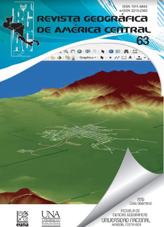
Geographic information systems and hydraulic modeling of potable water supply networks: case studies in the province of Guanacaste, Costa Rica
DOI:
https://doi.org/10.15359/rgac.63-2.11Keywords:
Geographic Information Systems (GIS); hydraulic modeling; water distribution networks; aqueductsAbstract
Design and analysis methodologies for aqueduct and sewerage systems have been changing with the emergence of new tools and technologies that, in addition to simplifying these processes, are increasingly reliable and precise. The direct application of these new technologies has greatly improved the way in which drinking water and sanitation projects are planned, designed and built in the country. Hydraulic modeling of networks is a methodology that has been applied for several years, both for the analysis and design of drinking water networks and sewage networks. The most recent versions of hydraulic modeling software have the enormous advantage of being compatible with Geographic Information Systems (GIS). The present investigation shows a theoretical and methodological procedure used to simplify hydraulic modeling through the capture and systematization of data in a GIS, as well as a series of results obtained from specific cases in network systems throughout the province of Guanacaste in Costa Rica.
References
Bejarano, E. (2013). Diagnóstico del acueducto de Santa Cruz y propuestas de mejora. (Proyecto de graduación para obtener el grado de Licenciatura en Ingeniería Civil, Escuela de Ingeniería Civil), Universidad de Costa Rica, San José, Costa Rica.
Bentley Corp. (2012). Recuperado el 10 de julio de 2012 del sitio web de Bentley Corp.: http://docs.bentley.com/es/InRoads/InRoads_Suite_Help/reference_information/file/new/typesofsurfacefiles.htm
Buzai, G. D. (2011). Geografía y Sistemas de Información Geográfica (Evolución teórico-metodológica hacia campos emergentes): Conferencia Magistral XIII EGAL Costa Rica 2011. Universidad Nacional de Luján, Programa de Estudios Geográficos, Argentina.
Cervera, B. y Rodríguez, J.A. (2008). Captura de información alfanumérica. México: Alfaomega.
Comas, D. y Ruiz, E. (1993). Fundamentos de Sistemas de Información Geográfica. Barcelona: Editorial Universidad de Barcelona, España.
Foresman, T. (1998). The history of the geographic information systems: pespectives from the pioneers. Prentice Hall: Upper Sanddle River. USA.
Instituto Costarricense de Acueductos y Alcantarillados (AyA) (2010b). Datos de inversión, rezago y proyectos de los sistemas AyA. Subgerencia de Ambiente, Investigación y Desarrollo, Pavas, Costa Rica.
Instituto Tecnológico de Costa Rica (2008). Atlas cantonal digital. ITEC. Cartago, Costa Rica.
Moreno, A. (2008). Sistemas y análisis de la información geográfica: manual de autoaprendizaje con ArcGIS. México: Alfaomega Grupo Editor.
O`Sullivan, D. y Unwin, D. (2003). Geographic Information analysis. Hoboken (NJ): John Wiley and Sons. New York, USA.
Rodríguez, J.A. (2008). El modelo de datos vectorial: características y formatos. México: Alfaomega.
Downloads
Published
How to Cite
Issue
Section
License
Proposed policy for journals offering Open Access
Authors publishing their works in the Journal acknowledge and agree to the following terms:
a) Authors retain the copyrights to their works and guarantee the Journal the right to be the first to publish their works, under the Creative Commons License Attribution-NonCommercial-ShareAlike 4.0 International, CC BY-NC-SA 4.0 International (https://creativecommons.org/licenses/by-nc-sa/4.0/deed.es), which allows others to share works upon complying with the acknowledgment of authorship and mention of the Journal as the original publisher of the work.
b) Authors are permitted to separately establish additional agreements for the non-exclusive distribution of the official edition of the work published in the Journal (for example, authors may desire to place the work in an institutional repository or incorporate it into a book that is to published elsewhere) so long they acknowledgment to recognize the Journal as the original publisher. The aforementioned additional agreements must respect the terms of the non-profit character and sharing philosophy of the original license (CC BY-NC-SA 4.0 International, https://creativecommons.org/licenses/by-nc-sa/4.0/deed.es).
c) Authors are encouraged to archive the post-print or editor/PDF version in Open Access repositories.


 REVGEO is licensed under https://creativecommons.org/licenses/by-nc-sa/4.0/deed.es
.svg_4.png)

_(1).png)
_(1)_(1)_(1)_1.png)
(2)(1)(1)(1).png)
