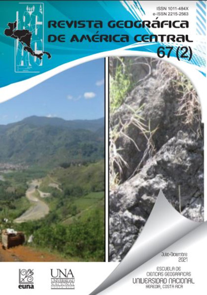
Geological interpretation of the folk legends of the Santa Lucía peak/volcano west of the Ujarrás Valley, Paraíso, Cartago, Costa Rica, and its relationship with particular elements of its physiographic context
no
DOI:
https://doi.org/10.15359/rgac.67-2.2Keywords:
Santa Lucia, Costa Rica, peak/volcano, UjarrásAbstract
The study area of the present investigation is located 4 km southeast of the city of Paraíso, de Cartago and west of the Ujarrás Valley, the objective was to propose a geological interpretation of the folk legends collected in Prado’s book Nuestra Señora de la Virgen de Ujarrás (1921) (translated as Our Lady of the Virgin of Ujarrás) linked to the alleged existence and activity of a peak or volcano known as Santa Lucía or El Picacho. For this endeavor, it was initially necessary to perform a compilation of historical information as well as field collection of particular evidence of the associated physiographic context; next, field collected data and geospatial inputs were analyzed and integrated for the preparation of results. From the identified tectonism in the immediate geographical area and its possible natural interactions, it is feasible to support an assertive geological interpretation, of non-volcanic nature, regarding the origin of the folk legends in connection to the alleged existence of the Santa Lucía peak/volcano in the Ujarrás Valley.
References
Archivo Nacional de Costa Rica (ANCR). (2020). Álbum de Figueroa con la Cuadrícula de la Villa de Ujarrás, 1824 [https://www.archivonacional.go.cr/index.php?option=com_phocagallery&view=category&id=56:59-74&Itemid=144].CR-AN-AH-JMFIGOR-ALBUM. Plano de la villa de Ujarrás en 1824. 1-063f.
Barrantes, M. (2011). Reportes de análisis petrográfico de rocas ígneas de las muestras: P0-1B, P08, P10 y P15. Instituto Costarricense de Electricidad. [reporte interno]. 8 págs
Benavides, M. (1999). De Ujarrás a Paraíso: análisis del traslado de una población 1821-1850. (Tesis de licenciatura). Universidad de Costa Rica, p. 387.
Bemis, K., Walker, J., Borgia, A., Turrin, B., Neri, M. & Swisher, C. (2011). The growth and erosion of cinder cones in Guatemala and El Salvador: Models and statistics. Journal of Volcanology and Geothermal Research 201, pp. 39–52.
Bergoeing, J. & Malavassi, V. (1981a). Carta geomorfológica del valle central de Costa Rica. Hoja Tapantí 1:50 000 Map 3445 –III. Ed. Inst. Geof. Nac. Costa Rica.
Bergoeing, J. & Malavassi, V. (1981b). Carta geomorfológica del valle central de Costa Rica. Hoja Istarú # 3445 IV, escala 1:50000. Ed. Inst. Geof. Nac. Costa Rica.
Bolaños, R., Quirós, M., Alvarado, S., Quirós, E., Orozco, C., Solano, J. & Rojas; C. (1993). Ayer Ujarrás, hoy Paraíso. Ed Servitex Flores, Universidad de Texas, p. 299.
Brenes, V. (2018). La devoción a Nuestra Señora de la Pura y Limpia Concepción del Rescate de Ujarrás: Un estudio de la mentalidad religiosa en Costa Rica: 1593-1852. Universidad de Costa Rica. Tesis sometida a consideración de la Comisión del Programa de Posgrado en Historia para optar por el título de Maestría Académica en Historia, p. 340.
Campos, M. & Orozco, D. (2011). Villa de Ujarrás: una propuesta desde la arqueología para analizar la dinámica socioeconómica en Costa Rica desde finales del siglo XVI hasta inicios del siglo XIX. Universidad de Costa Rica. Tesis para optar por el grado de Licenciatura en Antropología con énfasis en Arqueología, p. 260.
Chaves, R. (2010). Informe de perforación del Pozo TP-47. Empresa Santos Limitada, p. 8.
Curewitz, D. & Karson, J. (1997). Structural settings hydrothermal outflow: Fracture permeability maintained by fault propagation and interaction. Journal of volcano logy and geothermal research 79, pp. 148-168.
Custodio, E. & Llamas, M. (2001). Hidrología Subterránea. Ed. Omega, Barcelona, España. 2350 págs.
Denyer, P., Montero, W. & Alvarado, G. (2009). Atlas Tectónico de Costa Rica. Costa Rica: Ed. Universidad de Costa Rica. 81 p.
Dóndoli, C. & Torres, A. (1954). Estudio Geoagronómico de la Región Oriental de la Meseta Central.- Min. Agricultura e Ind., San José. 180 págs.
Fidani, C. (2010). The earthquake lights (EQL) of the 6 April 2009 Aquila earthquake, in Central Italy Nat. Hazards Earth Syst. Sci., 10, pp. 967–978, [www.nat-hazards-earth-syst-sci.net/10/967/2010/ doi: http://dx.doi.org/10.5194/nhess-10-967-2010].
Giggenbach; W. (1988). Geothermal solute equilibria. Derivation of Na-k-Mg-Ca. geoindicators. Geochimica et Cosmochimica Acta, 52, 2749-2765.
Giggenbach, W. & Goguel, R. (1989). Collection and analysis of geothermal and volcanic water and gas discharges. Report No. CD 2401. Department of Scientific and Industrial Research. Chemistry Division. Petone, New Zealand.
González, C. (1910). Temblores, terremotos, inundaciones y erupciones volcánicas en Costa Rica 1608-1910. 239 págs., San José: Tipografía de A. Alsina, 1910. Reimpresión Editorial Tecnológica, Cartago, Costa Rica 1994.
Instituto Costarricense de Electricidad (ICE). (2011-2012). Reporte de resultados químicos de muestras de agua BE-42. BE-40b y BE-42b. [reporte interno] 2 p.
JAXA/METI. (2011). ALOS PALSAR Hi-Res Terrain Corrected 2011 (AP 26652 FBS F0190 RT1). Accedido a través de ASF DAAC [https://www.asf.alaska.edu] el 3 febrero 2019. DOI: http://dx.doi.org/10.5067/Z97HFCNKR6VA.
Krushensky, R. (1972). Geology of the Istarú Quadrangle, Costa Rica. Geological Survey Bulletin 1358. – 46 p.
Linkimer, L. (2002). Intensidades del sismo de Bijagua de Upala (mw= 5,4), 27 de enero del 2002. Instituto de Investigaciones en Ingeniería, Laboratorio de Ingeniería Sísmica, Universidad de Costa Rica,10 p.
Montero, W., Linkimer, L. & Rojas, W. (2016). El Sistema de Falla Navarro: desplazamientos izquierdos a lo largo del cinturón deformado del centro de Costa Rica. Revista Geológica de América Central 55, 71-100, 2016 DOI: http://dx.doi.org/10.15517/rgac.v55i0.27062 ISSN: 0256-702.
Mora, G. (1998). Ujarrás de doctrina indígena a Villa Mestiza. Compiladores: Bozzoli de Wille, M. E., Barrantes, R., Obando, D., & Rojas, M. (1995). Memorias de I Congreso científico sobre pueblos indígenas de Costa Rica y sus fronteras. San José, Costa Rica: Editorial de la Universidad de Costa Rica. 504 págs.
Nicholson, K. (1993). Geothermal fluids- Chemistry and exploration techniques. - 263págs.Springer-Verlag Berlín Heidelberg New York.
Obando, L. (2004). Mega-rasgos geomorfológicos del modelo de elevación digital, asociados al Volcán Barva. Revista Geológica de América Central, 3, 81-86, ISSN: 0256-7024.
Ortiz, E. & Montoya, C. (2014). Atlas Digital de Costa Rica 2014 [CD-ROM]. Instituto Tecnológico de Costa Rica. Escuela de Ingeniería Forestal.
Peraldo, G. & Montero, W. (2007). Temblores documentados para el periodo colonial de Costa Rica. Revista Geológica de América Central, 36 Especial, 25-47.
Powell, T. & Cumming W. (2010): Spreadsheets for geothermal water and gas geochemistry In: Proccedings of Thirthy-Fifth Workshop on Geothermal Reservoir Engineering, Stanford University, Stanford, California, February 1-3, 2010.
Prado, E. (1921). Nuestra Señora de la Virgen de Ujarrás. 3 ed. San José, Costa Rica: Costa Rica.
Quirós, T. (1981). Ujarrás. San José: Editorial Costa Rica.págs.80
Sanabria, I. (2014). Propuesta de modelo conceptual geotérmico de baja entalpia para el Valle de Orosí, Paraíso, Cartago, Costa Rica - San José, Costa Rica: Escuela de Geología-UCR, 2014 - 146 páginas.
Schoeller, H. (1962). Hydrologie dynamique et chemique, Recherche, Explotation et evaluation des resources. - 642 págs Manson et cie editeurs.
Sistema Nacional de Información Territorial (SNIT). (2020). Infraestructura Nacional de Datos Espaciales de Costa Rica. Recuperado de: www.snitcr.go.cr.
Sojo, D., Denyer, P., Gazel, E. y Alvarado, G. (2017). Geología del cuadrante Tapantí (1:50 000), Costa Rica. Revista Geológica de América Central, 56: 83-116, Doi: http://dx.doi.org/10.15517/rgac.v0i56.29238.
Sojo, D. (2018). Geología de la hoja Paraíso (1:10 000), Costa Rica. Revista Geológica de América Central, 59, 101-124, 2018 doi: http://dx.doi.org/10.15517/rgac.v59i0.34161 ISSN: 0256-7024.
Thériault, R., ST-Laurent, F., Freund, F. T., And Derr, J. S. (2014). Prevalence of Earthquake Lights Associated with Rift Environments. Seismological Research Letters, 85, no. 1, 159–178. doi: http://dx.doi.org/10.1785/0220130059.
United States Geological Survey. (USGS) (2019). What are earthquake lights? Accedido a través de https://www.usgs.gov/faqs/what-are-earthquake-lights?qt-news_science_products=0#qtnews_science_products el 24 de febrero de 2019.
Valenzuela, E. (2011). La leyenda: un recurso para el estudio y la enseñanza de la Geografía. I Revista de Investigación de la Universidad Simón Bolívar, ISSN-e 1665-692X, Nº. 10.
Vargas, A. (2016). Influencia del sismo de golfito del 30 de julio de 2002 (Mw 6,2) sobre una prueba de bombeo en el acuífero confinado del sitio de presa del P.H. Pirrís, Costa Rica. Revista Geológica de América Central 54, 143-153, 2016 DOI: http://dx.doi.org/10.15517/rgac.v54i0.21151 ISSN: 0256-7024.
Vázquez, E. & Serrano, A. (2012). Software EASY_QUIM v.5.0 del Grupo de Hidrología Subterránea (GHS) del Departamento de Ingeniería del Terreno de la Unidad Politécnica de Catalunya (UPC). https://h2ogeo.upc.edu/es/investigacion-hidrologia-subterrania/software/42-easy-quim el 20 de mayo de 2019.
Villa, V. (2013). Morfología de estructuras volcánicas cenozoicas de los andes centrales entre los 25º y 26º s, Chile. Memoria para optar al título de geólogo. Facultad de Ciencias Físicas y Matemáticas. Departamento de Geología. Universidad de Chile 97 págs.
Zuidam, R. (1986). Aerial photo-interpretation in terrain analysis and geomorphologic mapping; with contributions from F.I. van Zuidam-Cancelado and other members of the International Institute for Aerospace Survey and Earth Sciences (ITC), 442 págs.
Downloads
Published
How to Cite
Issue
Section
License
Proposed policy for journals offering Open Access
Authors publishing their works in the Journal acknowledge and agree to the following terms:
a) Authors retain the copyrights to their works and guarantee the Journal the right to be the first to publish their works, under the Creative Commons License Attribution-NonCommercial-ShareAlike 4.0 International, CC BY-NC-SA 4.0 International (https://creativecommons.org/licenses/by-nc-sa/4.0/deed.es), which allows others to share works upon complying with the acknowledgment of authorship and mention of the Journal as the original publisher of the work.
b) Authors are permitted to separately establish additional agreements for the non-exclusive distribution of the official edition of the work published in the Journal (for example, authors may desire to place the work in an institutional repository or incorporate it into a book that is to published elsewhere) so long they acknowledgment to recognize the Journal as the original publisher. The aforementioned additional agreements must respect the terms of the non-profit character and sharing philosophy of the original license (CC BY-NC-SA 4.0 International, https://creativecommons.org/licenses/by-nc-sa/4.0/deed.es).
c) Authors are encouraged to archive the post-print or editor/PDF version in Open Access repositories.


 REVGEO is licensed under https://creativecommons.org/licenses/by-nc-sa/4.0/deed.es
.svg_4.png)

_(1).png)
_(1)_(1)_(1)_1.png)
(2)(1)(1)(1).png)
